Commoner Action
In this place we call home, land is bounded and owned by many different private and public entities: individuals, businesses, and non-governmental organizations, plus municipal, state, and federal government. But there are certain elements of this home place that are not owned by anyone in particular—they are unbounded, unenclosed, and they are shared and used and owned by all Vermonters. These elements are commons.
In Vermont’s natural landscape, three significant commons exist—water, wildlife, and air. We the people who inhabit and share these commons have the right, responsibility, privilege, necessity and pleasure of ensuring that these commons are well cared for. Soaring atmospheric carbon levels, declining native wildlife species abundance and diversity, and impaired water quality reveal the extent of the work to be done to safeguard our commons. It’s time to step up and step in as engaged commoners.
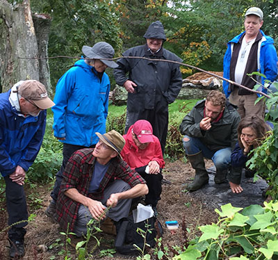
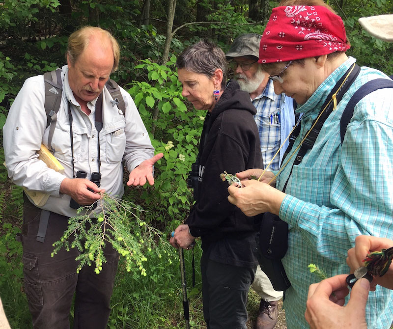
One great way to step up in through volunteer monitoring of water, wildlife and air. Such volunteer work often goes by the name of citizen science. We like the term “Commoner Science,” to celebrate our membership in the land community and broaden engagement beyond western “objective” scientific monitoring.
The way we see it, Commoner Science includes imagining, manifesting, mapping, monitoring, designing, and implementing Optimal Commons Conservation Practices while compassionately, gratefully, and prudently caring for the land and the people of this still-sweet, healthy, beautiful, productive part of Mother Earth we get to call home.
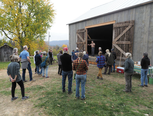
Here are a few of the existing Commoner Science initiatives within Vermont’s Center-West Ecoregion that you can take part in.
Vermont Reptile and Amphibian Atlas
The Vermont Reptile and Amphibian Atlas (also known as the Herp Atlas, since the study of reptiles and amphibians is known as herpetology) gathers, interprets, and shares data on the reptiles and amphibians of Vermont. Thanks to the efforts of project coordinator Jim Andrews and his team, along with the field observations of thousands of volunteers, the VT Herp Atlas documents the distribution and relative abundance of reptiles and amphibians in Vermont, as well as natural history information, calling times, and relative sizes. The relative abundance and relative distribution information has greatly helped prioritize conservation efforts.
Your field sightings, recordings, and photographic documentation are critical to updating and improving the Atlas. It’s easy and straightforward to submit observations to the VT Herp Atlas. There are no assigned territories or required training sessions. Visit their website to learn how to submit observations in whatever format works best for you.
The website, updated in 2018, has totally new distribution maps, an updated searchable table, updated species accounts, new and updated photos, new links, and many other updates.
Vermont Family Forests is proud to serve as fiscal agent for the VT Herp Atlas, administering funds for this outstanding citizen/commoner science program.
Addison County River Watch Collaborative
Since 1997, citizen scientist volunteers with the Addison County River Watch Collaborative have monitored and assessed the condition of our local rivers, from their mountain headwaters through the Champlain Valley. The Collaborative raises public awareness of the values and functions of our watersheds and supports community action that improve water quality. ACRWC volunteers gather water quality data on Otter Creek, New Haven River, Lewis Creek, Little Otter Creek, Lemon Fair River, and Middlebury River.
Volunteers work in teams to monitor a particular river site once a month. Take a look at their engaging instructional video to get a clear idea of the water quality monitoring process.
Such monitoring is a critical part of assessing the impacts of land use on water quality. In the forested headwaters of the Center-West ecoregion, such water quality monitoring can shed light on the effectiveness of forest conservation practices.
eBird
Here in the Center-West Ecoregion, volunteer bird enthusiasts have contributed thousands of lists of bird sightings at hundreds of sites to the Cornell Laboratory of Ornithology’s eBird program–the world’s largest biodiversity-related citizen science project. Each year, eBirders around the world contribute more than 100 million bird sightings to the eBird database. At birding hotspots like Dead Creek Wildlife Management Area, volunteers have submitted more than 3000 bird lists, recording 238 different species. Up in Lincoln, eBird records for Vermont Family Forests’ Abraham’s Knees parcel have tallied 52 bird species so far.
Whether you’re an enthusiastic beginner or an experienced birder, your sightings contribute important data to the eBird database. This database helps scientists monitor population trends and helps inform conservation projects. So grab your binoculars and jump in! See their website for details on how to submit observations.
Vermont Lay Monitoring Program
This citizen/commoner science program, run by the Vermont Agency of Natural Resources’ Department of Environmental Conservation, monitors water quality in lakes across Vermont. Through the Vermont Lay Monitoring Program, volunteers can help monitor lake water transparency, phosphorus (nutrient) concentration, and chlorophyll-a (algae and cyanobacteria) concentration. Visit their website to learn how to take part.